After Hurricane Katrina, Monitoring Levees Gets a National Approach
This year marks the 20th anniversary of Hurricane Katrina, one of the most devastating storms to hit the United States—killing nearly 1,400 people and resulting in an estimated $125 billion in damage.
In the wake of Katrina, many criticized the failures of levees—walls and other structures meant to keep areas from flooding—for the scale of death and damage to New Orleans and surrounding areas. Since then, there have been efforts to better inventory and assess the condition of levees.
Today’s WatchBlog post looks at our new report on the status of these efforts.
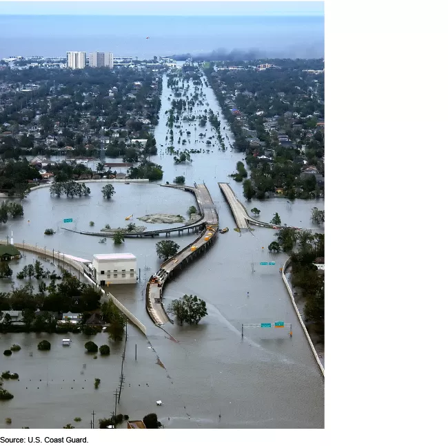
Flooding from Hurricane Katrina in New Orleans, 2005
Image
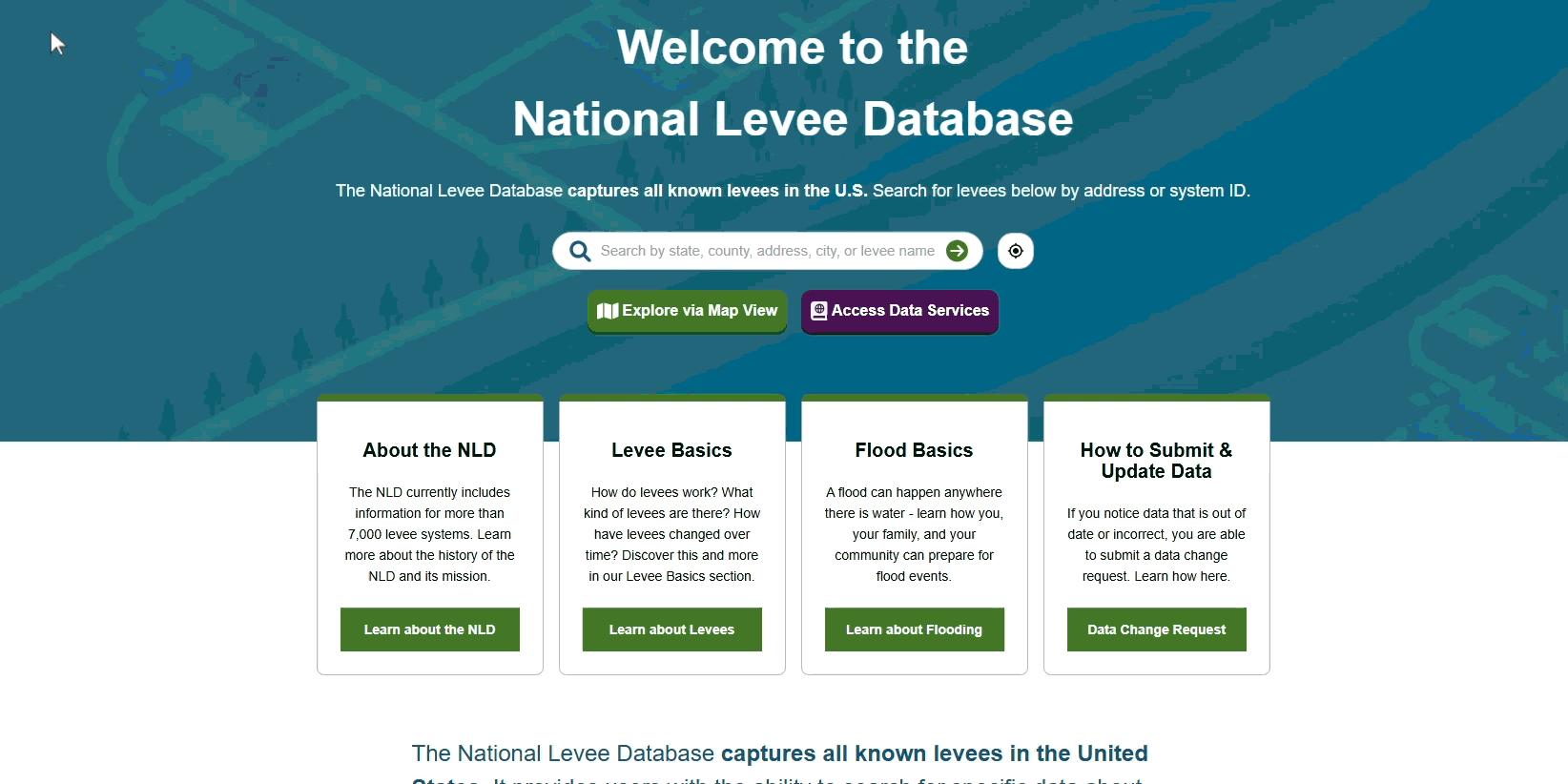
The National Levee Database
There are about 7,000 known levees nationwide. The Army Corps of Engineers (the Corps) operates and maintains 150 of these and oversees about 1,450 additional levees. The remainder are operated and maintained by other entities, such as private landowners.
After Hurricane Katrina, the Corps established a database of the nation’s levees—the National Levee Database. This was the first centralized repository of information about these structures. Its goal was to help decision makers better understand the location and condition of levees. It also helps decision makers and the public understand flood risks and support community preparedness.
What does the database show?
The database includes the locations and conditions of all known levees in the United States. The extent of details for each structure varies. But generally the database includes a summary of the key characteristics of the levee—such as its history and the nearby waterways it was built to protect from.
The database is publicly available. Users can either search for a specific location or find nearby levees. Click here or on the image below to visit the National Levee Database.
Image
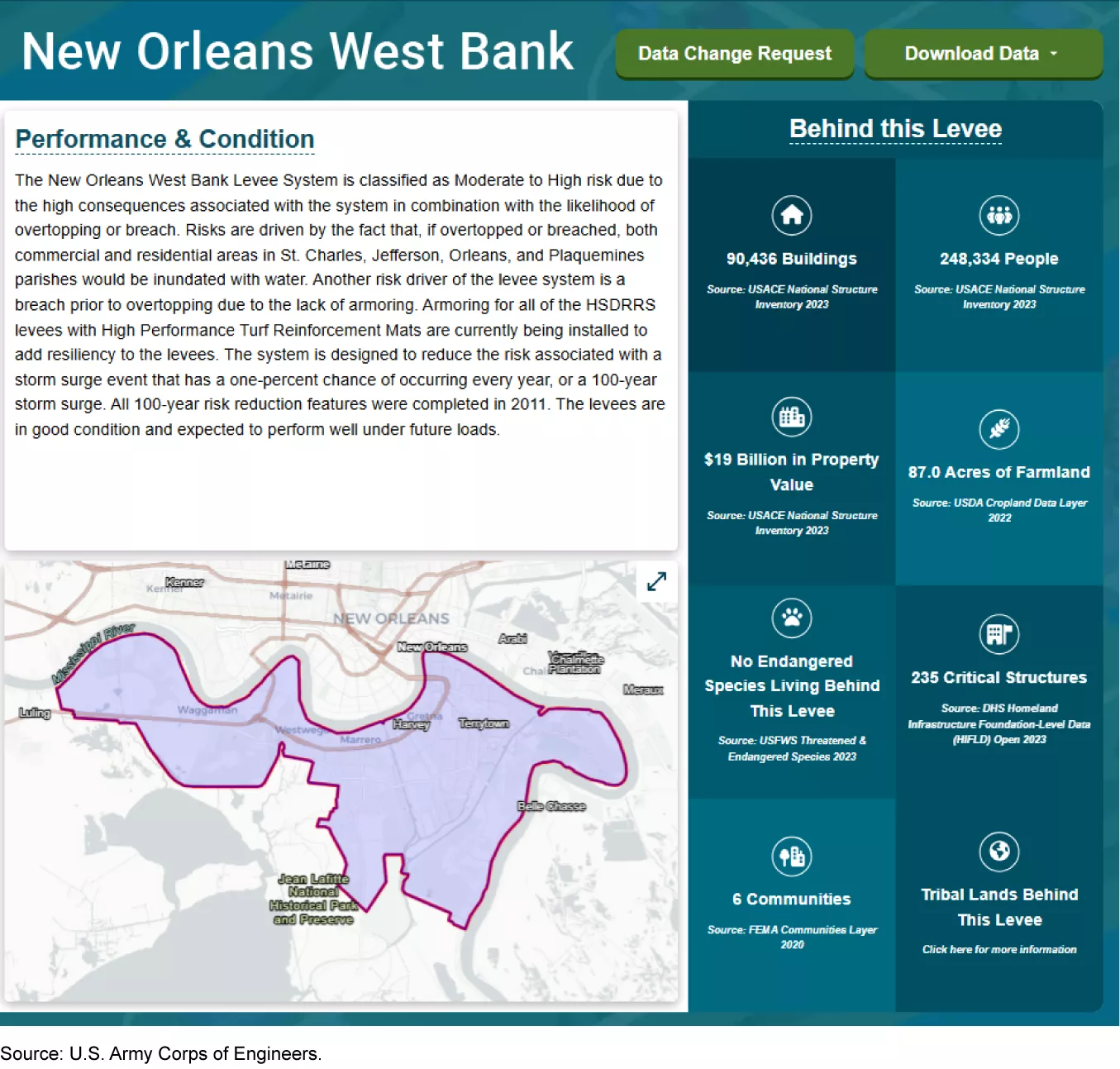
For homeowners and locals, the database is an important resource for understanding more about their local levees and flood risks. Residents and business owners can use it to see if their area is protected by a levee. If it is, users can also see when the levee was built, when it was last inspected, and who is responsible for maintaining it.
The database also shows the number of people and buildings that are protected by the levee, as well as an estimate of the property values behind the levee.
Example of Data Available in the National Levee Database
Image
For communities, the database may provide some insights into how their levees might affect the need for insurance under the National Flood Insurance Program and the premiums they would pay. The database is used by the Federal Emergency Management Agency (FEMA) to create a rating for levees. These ratings are just one piece in how national flood insurance premiums are calculated. There are 21 other factors used in calculating these premiums, and levee conditions alone may not have a substantial effect. However, they do provide context alongside other geographic, policy, and structural factors that go into setting these premiums.
How can decision makers use the database going forward?
As extreme weather events continue to pose risks to America’s communities, the database can help decision makers better plan for the future, especially in areas prone to flooding.
By using the data, decision makers can better understand what actions, such as levee improvements, are needed to protect against flooding. The database can also help with community engagement about potential risks to lives and property, and can support data-driven decisions about how to manage these risks.
- GAO’s fact-based, nonpartisan information helps Congress and federal agencies improve government. The WatchBlog lets us contextualize GAO’s work a little more for the public. Check out more of our posts at GAO.gov/blog.
- Got a comment, question? Email us at blog@gao.gov.
GAO Contacts


Related Products
GAO's mission is to provide Congress with fact-based, nonpartisan information that can help improve federal government performance and ensure accountability for the benefit of the American people. GAO launched its WatchBlog in January, 2014, as part of its continuing effort to reach its audiences—Congress and the American people—where they are currently looking for information.
The blog format allows GAO to provide a little more context about its work than it can offer on its other social media platforms. Posts will tie GAO work to current events and the news; show how GAO’s work is affecting agencies or legislation; highlight reports, testimonies, and issue areas where GAO does work; and provide information about GAO itself, among other things.
Please send any feedback on GAO's WatchBlog to blog@gao.gov.